


| WEATHER STORY Jackson Weather Forecast Office |

|
|||
|
|||
 |
|||
|
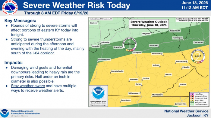
A strong storm system moves through the region from Wednesday night into Thursday. While there are a few failure modes with this setup in #KYwx, impactful weather remains possible. A line of storms arrives along the I-64 corridor early Thursday Morning, then additional activity develops (and potentially trains) in Southern KY on Thursday afternoon/night. This activity poses risks for wind damage and heavy rain, so stay tuned for updates. Even the non-thunderstorm wind gusts will be strong on Wednesday night, so it's a good idea to secure loose objects ahead of time tomorrow!
|
Data Courtesy of Jackson Weather Forecast Office